AI & Sustainability in the EO Industry: An honest look at the promise and the cost
Every day, satellites circle our planet, collecting massive amounts of data about forests, coastlines, cities, and farmland. More than any team of analysts could ever read. The EO industries bottleneck is not a shortage of pixels but our ability to make sense of them quickly enough to act on what they show. This is where artificial intelligence has become essential to Earth observation, and it is why the question of whether AI can help build a more sustainable future is not abstract for our industry. It is now a practical, everyday one.
It is also a question worth asking honestly, because AI is not automatically a force for good. It carries a real environmental cost of its own. That’s why we need to look at it from all side: where AI genuinely improves sustainability, where the criticism holds up, and what it takes to use it responsibly.
What AI is already doing in Earth observation
Artificial Intelligence is software that learns patterns from data instead of following rules a person wrote out in advance. In Earth observation, that ability has gone from a research curiosity to something the field now depends on, because satellites produce far more imagery, containing far more information, than anyone could ever review and extract by hand.
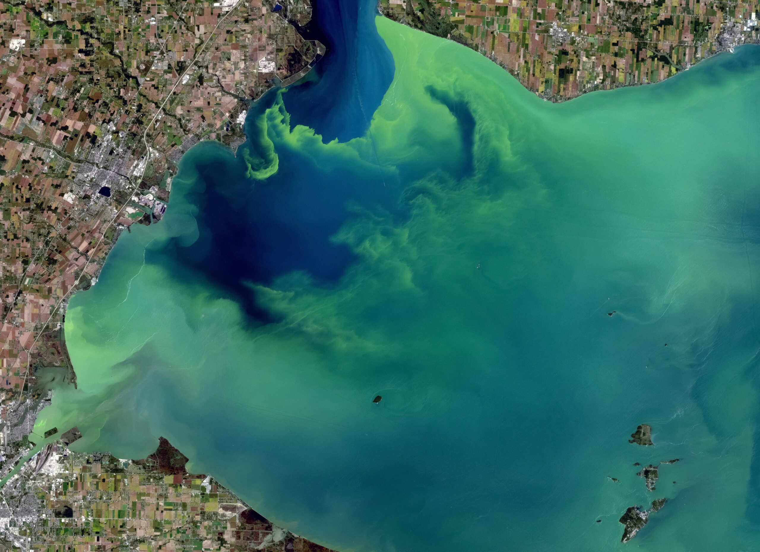
Today AI works across the whole EO chain. It monitors land cover and crop health, and it detects deforestation, land degradation, and new construction across areas far too large to check manually. It combines optical, radar, and thermal sensors so that cloud and darkness no longer hide what is happening on the ground. The European Space Agency has even put AI directly onto its satellites, processing radar imagery in orbit so that only the useful results travel back to Earth rather than the full volume of raw data.
The clearest trend is the move from monitoring to prediction. For a long time Earth Observation has been able to tell us what has already happened: a forest cleared, a coastline eroded, a mine expanded. The new use cases are moving towards anticipation. Models trained in past and simulated patterns are increasingly able to say where deforestation is likely to spread, which areas carry the most risk, and how a landscape will respond to drought or extreme weather before the damage is done. That move, from reacting to events to seeing them coming, is the most important thing AI is bringing to our work.
The footprint we can’t ignore
Any honest claim that AI helps the planet must also take into account what AI itself costs the planet, and that cost is real and growing.
According to the International Energy Agency, electricity demand from data centres is on course to roughly double, from around 485 terawatt-hours in 2025 to about 950 terawatt-hours by 2030. That is close to the entire electricity consumption of Germany and France combined, and about 3 percent of global demand. Also, demand from AI-focused facilities alone rose by roughly 50 % in a single year. On top of the electricity there is the water used for cooling and the concentrated demand for the critical minerals that go into the hardware. The footprint is not in question.
There is a less obvious problem as well. AI is a general tool with no values of its own. The same model that detects environmental harm can just as easily optimise the activity causing it. ‘AI for sustainability’ is a claim to be earned case by case, not a label that makes itself true.
There is another side to this, though. The same agency notes that data centres still make up less than 1% of global carbon emissions. More importantly, it expects that using the AI tools we already have more widely could save several times more emissions than data centres produce, somewhere around 5% of all energy-related emissions by 2035. The cost is real, but the upside could be larger. Whether AI helps the climate or harms it comes down to how we use it, not to the technology itself.
Where Earth observation reaches its limits
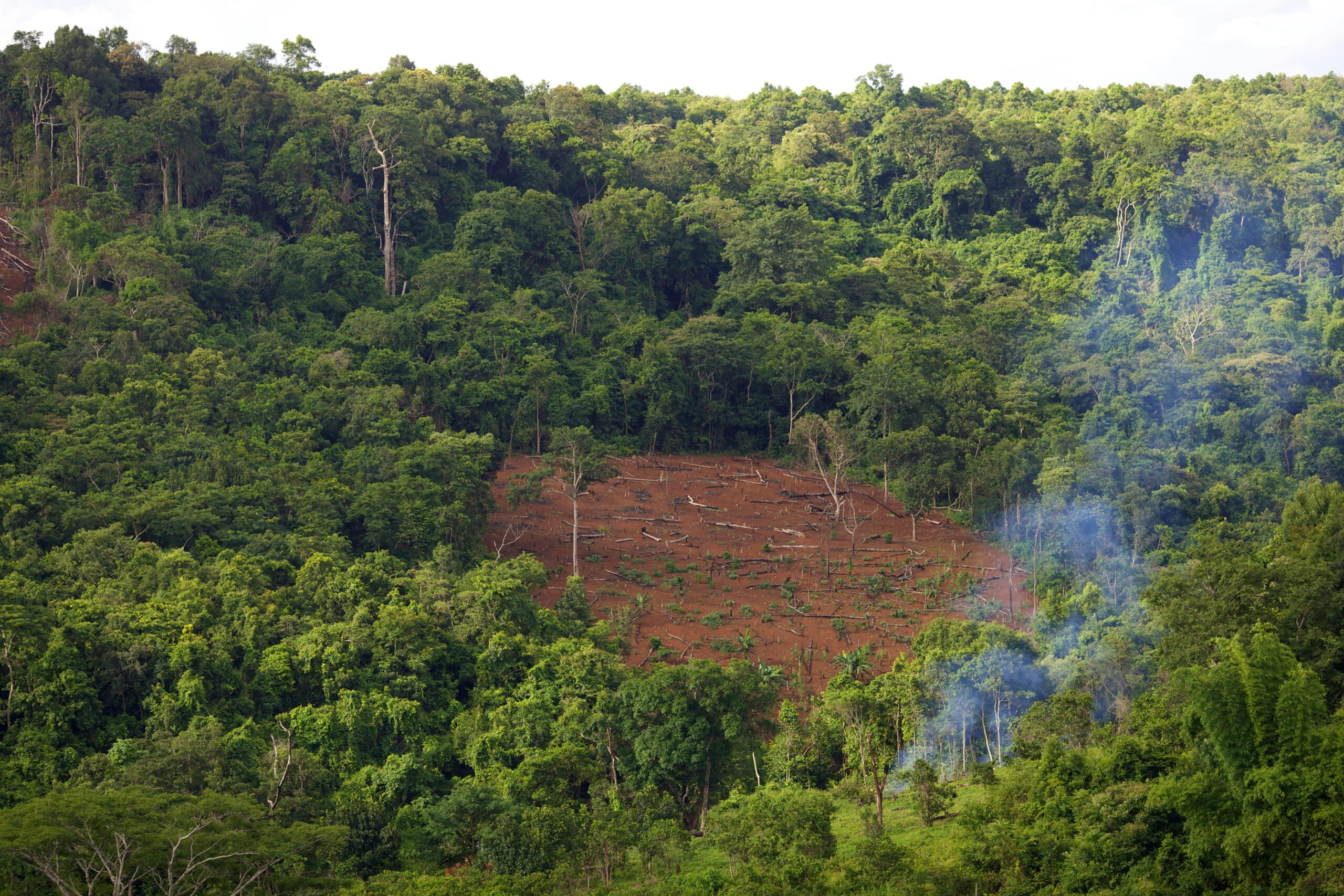
Earth observation exists to help with concrete environmental problems: stopping deforestation and illegal extraction before they spread, protecting biodiversity and fresh water, preparing for drought and flood and battling pollution as a whole. Satellites are very good at seeing all of this. The trouble is that seeing is not the same as solving, and a stubborn gap sits between what a satellite can observe and what actually changes on the ground.
Speed is the essential component within this challenge. Damage has to be caught while it can still be stopped, and a lot of monitoring is simply too slow to do that. By the time imagery has been collected, processed, and reviewed, the forest is already cleared or the wetland already drained. For illegal logging and mining, a few weeks decide whether anyone arrives in time.
Where the monitoring happens matters as much as how fast it happens. The places that count most, like tropical forests, smallholder farmland, the remote edges of the Global South, tend to have the thinnest and least consistent data. They’re covered by clouds for much of the year, and their earliest signs of stress are subtle enough that ordinary analysis often misses it. Coverage is weakest in exactly the spots where the stakes are highest.
Harder still is looking forward rather than back. Most of the value is in knowing what is about to happen, not what already has. Where will clearing spread next season, which areas will flood or dry out, where will a pest or disease manifest? Earth observation is built to record the present and the past, and a changing climate keeps producing conditions with no precedent to learn from, so the future stays difficult to read from imagery alone.
And even when the data exists, most of it never turns into a decision. Imagery builds up faster than anyone can work through it, results often arrive too late to be useful, and the people who need them most, like environmental agencies, forest services, and local communities, often cannot get hold of the data or do not have the tools to use it. Collecting more of the planet means little if none of it reaches someone who can act.
All of this carries a cost that is easy to overlook. Watching the whole planet, again and again, at high resolution is expensive in money and in energy. Capturing, moving, storing, and processing that much imagery adds to the same AI footprint described above, and in practice that expense decides how much of the world gets watched, and how often.
Another limit is trust, and it is one of the most important. More and more, Earth observation sits behind real accountability: carbon markets, the EU’s rules on deforestation and methane, company climate reports. When money and compliance depend on the result, getting it wrong is costly. Researchers have already shown that satellite-based carbon accounting can overstate how much carbon is stored and inflate offset claims when the methods behind it are not properly checked, and most carbon-credit buyers say reliability is their top concern. The whole system depends on verification people can actually trust, not just verification that runs automatically.
Step back and the limits share one root. In almost none of these cases is the real problem a lack of imagery. It is the gap between seeing something and doing something about it, and in environmental work that gap costs more than ordinary delay, because what you are watching usually cannot be undone. That gap is exactly where AI is useful.
How AI helps close the gap
Most of what AI does comes back to one thing. It shortens the trip from what a satellite sees to what a person can act on.
The clearest gains are in speed and reach. AI detects change far faster than any manual process and across areas no team could cover, and it works where monitoring used to break down. By combining optical, radar, and thermal data it sees through cloud and darkness, and it learns to pick up the faint early signals of stress, a thinning canopy, fragmentation, small shifts in moisture or surface temperature, that other methods miss. NASA researchers recently combined several satellites to flag tropical deforestation more than three months earlier than before. With around 10 million hectares of tropical forest lost each year, three months is the difference between stopping a clearing and recording it. That same speed is what finally helps with the value gap, because AI is the only realistic way to work through this much imagery and hand back a short, ranked list of what actually matters, while it still matters.
The larger shift is from reading the past to anticipating the future. Trained on historical and simulated patterns, models increasingly point to where deforestation will move next, which areas face flood or drought, and which forests are likely to decline before any of it shows up in a picture. That is what turns monitoring into prevention, and it is the change with the most leverage for the environment.
Trust is the one area where AI only helps on certain conditions, and methane shows both sides of it. Methane leaks are scattered and remote, which makes them hard to track, but AI models can now scan public satellite imagery and pick out plumes at individual sites every couple of days, feeding systems like the UN Environment Programme’s Methane Alert and Response System and pushing emissions data closer to enforcement. In carbon markets, AI can take over the slow, expensive field surveys that checking used to require. But the same automation that cuts costs can also multiply mistakes, so it only earns trust if the models themselves are independently checked. AI is a better verifier than what came before. It is not a replacement for scrutiny.
There is also a more hidden benefit. Used well, AI can make Earth observation lighter rather than heavier. The energy needed per task keeps falling, processing imagery on the satellite cuts how much has to be sent down and stored, and smarter ways of handling data, including generating synthetic training data instead of capturing and labelling ever more of the real world, reduce how much new imagery has to be collected at all.
What responsible deployment looks like
If the value of AI depends on how it is used, then using it responsibly comes down to a few concrete commitments rather than a slogan.
It means putting AI to work where the environmental benefit clearly outweighs its footprint, not simply everywhere it can technically go. It means checking the models we increasingly trust with environmental accountability, so that automated carbon and emissions monitoring earns its credibility instead of assuming it. It means closing the capacity gap, so that the agencies and communities on the front line can actually use the data and the tools, not only the organisations that can afford them. And it means building for efficiency rather than scale, doing more with less data, less compute, and fewer repeated captures.
That last point is where we focus at Another Earth. We are building the predictive data layer for the physical world, and it starts from something that runs through this whole piece: the problem is rarely a lack of imagery, it is a lack of usable training data. That is why we create high-resolution synthetic satellite data, built specifically to train and test the AI models used for environmental, biodiversity, and climate work. Because it comes ready-labelled, models can reach reliable performance on a fraction of the real-world data they would otherwise need. It is one piece of a much bigger puzzle, but it is the piece that helps organisations move from reactive monitoring to predictive planning, from cleaning up after a crisis to seeing it coming.
Our take
AI is one of the most powerful tools our industry has ever had, and it is already changing Earth observation. It speeds up how quickly we notice change, it extends monitoring into places we could never have afforded to watch before, and it turns a stream of images into something closer to foresight
But every powerful tool has a downside, and AI is no exception. It uses energy and water, it adds pressure to supply chains that are already strained, and it will serve a harmful goal as faithfully as a good one. The technology does not decide whether it helps the planet. We do.
So the honest answer to whether AI can drive a more sustainable future is yes, but only on purpose. It means using AI where the environmental payoff clearly beats the cost, building data and systems that do more with less, and being open about the trade-offs instead of pretending they are not there. That is the standard we try to hold ourselves to: building the data infrastructure that lets the most important ecosystems on the planet be seen, understood, and protected, while keeping the footprint of that work as light as possible.


Leave a Reply