

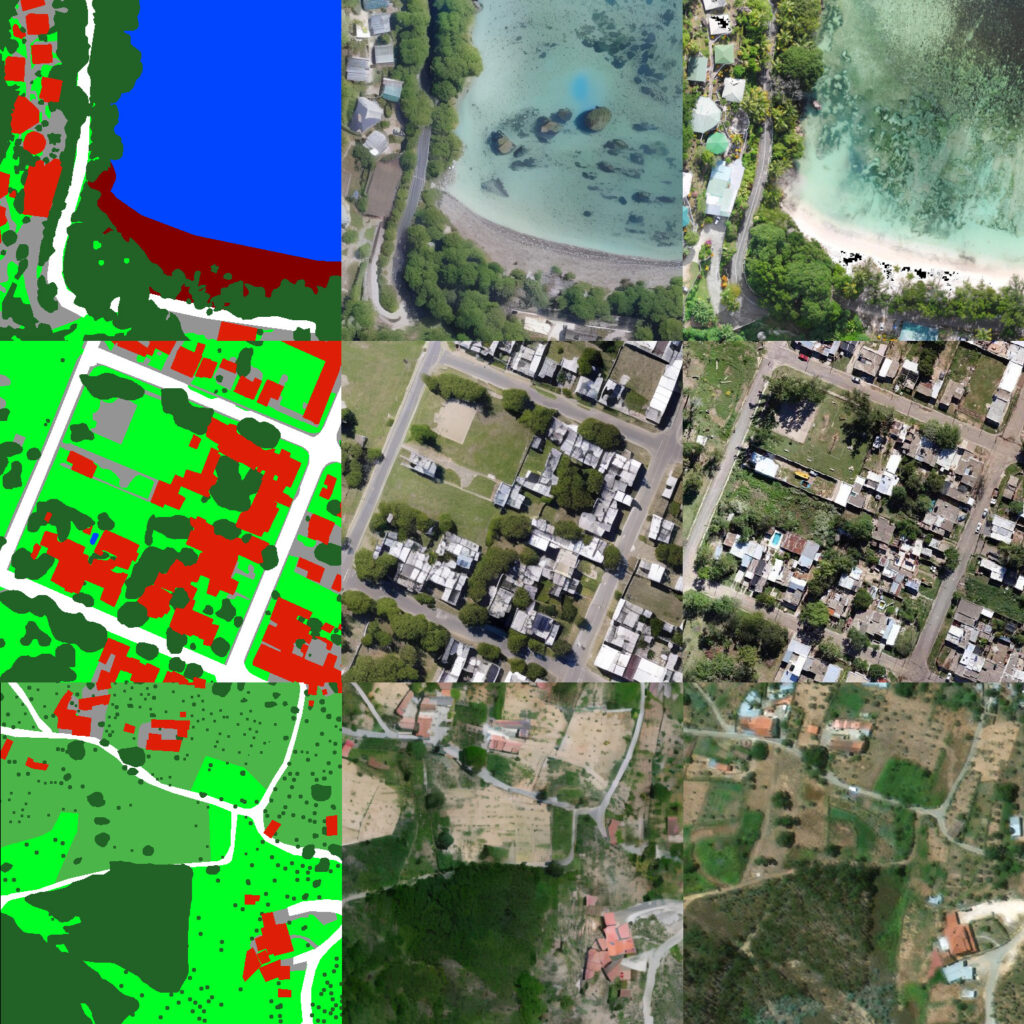
With Clarity, we introduce our own segmentation model. It generates segmentation masks from high-resolution satellite imagery from any place in the world and across different sensors.
Flexibility was the design priority. This is why Clarity now supports segmentation into 63 classes across multiple hierarchical levels with increasing complexity. At the top level, a scene is separated into water, vegetation, built-up and a fourth group for what obscures the surface below. Each of those opens into finer classes at every level below.
Within vegetation, for example, one of the classes is forest. From there, the taxonomy can identify increasingly specific categories, down to different types of forest and trees. The same applies to built-up areas: building from a class within built-up, which can then be further divided into categories such as industrial, urban or rural buildings.
This hierarchy lets our customers separate the classes relevant to their work without collapsing them into generic land cover categories. We keep the classes general, which is what lets them hold their meaning in every region rather than only in the ones the model was trained on.
Clarity operates across high-resolution imagery, from 1m down to 0,20 cm resolutions. As a single model, it handles coarse regional coverage and fine detail on an individual site, so teams don’t have to switch models when the scope of the analysis changes.
Clarity is a light model. Foundation models built for general segmentation carry the weight of everything else they were designed to do, which often makes them slow to run and demanding to set up. Clarity was built for segmentation alone, so it runs fast and is easy to use, which makes even larger tasks like covering a full region accessible. Its size also makes it possible to fine-tune, so a team working on a specific region or case can further improve performance.
Manual annotation costs weeks per dataset and depends on analyst availability, so scope gets cut to fit the labeling budget rather than the project at hand. Clarity returns the same masks in seconds, with no annotated dataset to start from. This lets teams segment an entire country where the budget previously covered only a few test sites.
Clarity is competitive against established segmentation models such as SAM and SegFormer, including imagery from regions it has not seen before.