AI-powered simulation and
synthetic data

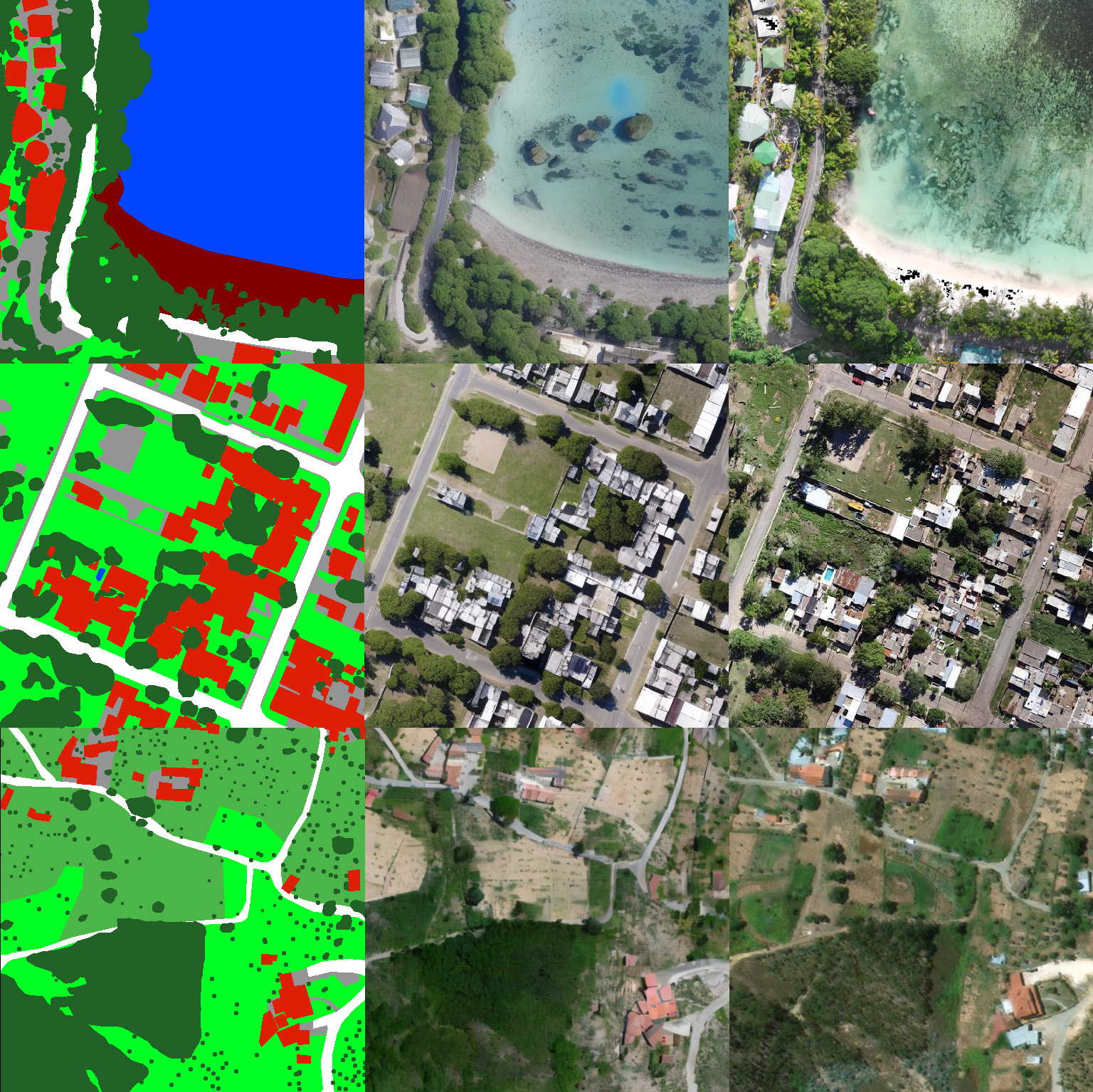
For Earth Observation and beyond

Scroll Down

AI-powered simulation and synthetic data

For earth observation and beyond

AI-powered simulation and synthetic data

For earth observation and beyond

Artificial Variations Of Our Planet’s Surface

A synthetic data and simulation engine to unlock deep and actionable insights from earth observation data.

Monitor the planet at scale – unlock deep insights across land, water, and infrastructure.

Simulate future scenarios – test potential scenarios with synthetic data that fills gaps and reduces bias.

Predict risk with confidence – train AI models to anticipate events and and their impact.

Enabling AI For Geospatial Data

Significantly shorten your development cycle to gain better insights faster.

An interdisciplinary team of serial entrepreneurs, geospatial AI experts and 3D engineers

We set out to bridge the gap between EO data and AI adoption and enable Earth Observation at scale.  

Our mission is to build powerful tools that make Earth Observation data truly actionable.

We empower anyone to understand and predict changes across our planet’s surface.

Full control of scenario modeling Pixel perfect labels Unlimited variations Multispectral possibilities Consistent temporal information Unbiased Data Ultra high & variable resolution

Industries we work in

01

Mining & Raw Materials

Drive responsible exploration and resource use with Synthetic Earth Observation data.

02

Environmental Monitoring

Monitor ecosystems, deforestation, and climate change at scale, simulate and predict future impact.

03

Synthetic Data for your Project

Power AI with limitless, high-quality data for faster, actionable insights.

what we do

We automatically generate unlimited variations of synthetic satellite imagery and the required labels to enable the training of scalable AI models - significantly accelerating the AI development cycle.

How we do it

We combine proprietary AI models and 3D processing into a powerful data engine that generates unlimited variations of synthetic satellite imagery and the required labels to enable the training of scalable AI models. 

Why we do it

Collecting and preparing training data is the biggest pain point in machine learning projects—costly, cumbersome, and time-intensive. This challenge is even greater in Earth Observation. We want to remove that barrier to unlock the full power of AI in Earth Observation and enable anyone to build AI projects with ease.

Data and Insights from ANOTHER EARTH. Unlock Geospatial AI at scale.